
- Day trips
- Outdoor activities
- Tours from Amadores
- Tours from Maspalomas
- Tours from Meloneras
- Tours from Playa del Ingles
- Tours from Puerto de Mogan
- Tours from Puerto Rico
- Tours from San Agustin
Gran Canaria hiking tours
Discover some of the most beautiful and spectacular sites in Gran Canaria by doing a hike. The care and traceability of the trails, the landscape diversity and the island’s yearlong spring climate make Gran Canaria a paradise for hikers.
Why go on guided hiking tours?
Even though you can hike on your own, we advise you to consider the guided tour option for these reasons:
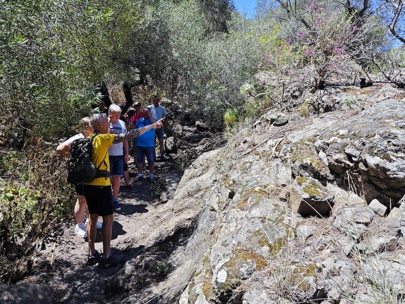
- Knowledge of the routes. The guides know the routes and each place you’ll visit perfectly. They’ll also give you, at times, some tips so you can go through the most difficult spots in the most appropriate way possible.
- Information from the guides. The guides will offer you information about the vegetation, fauna and most outstanding sites that you’ll find during the tour.
- Safety. Walk the trails calmly, accompanied by an expert guide trained as a mountaineering technician who knows the terrain well.
- Comfort. You just need to focus on booking and doing the tour. Everything else, including transportation, food, water, hiking poles, and a knowledgeable tour guide is included in the price.
- Insurance. In case of any accident, you’ll be covered during the tour by insurance that covers both rescue and any type of incident that may occur.
Place of tour departure
Walking trails in Gran Canaria
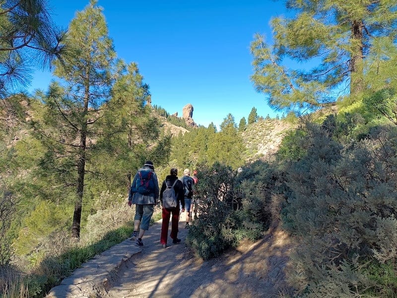
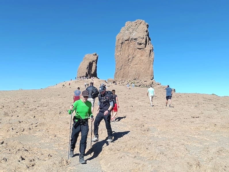
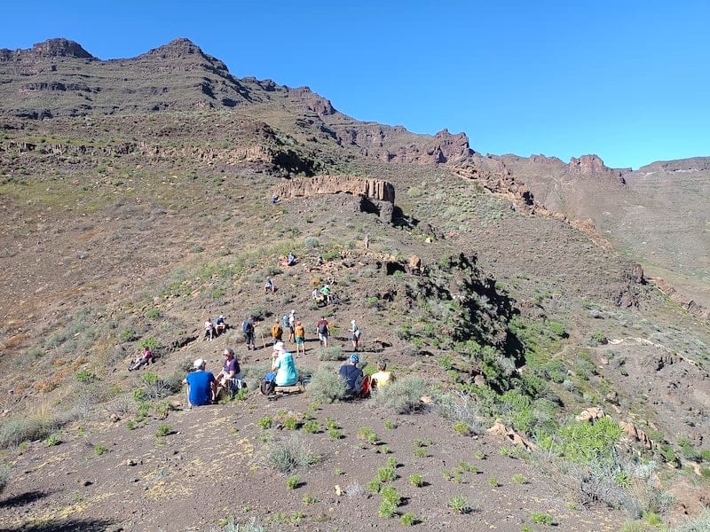
Rambling excursion to Roque Nublo
![[cml_media_alt id='20658']Recorrido senderismo Roque Nublo[/cml_media_alt]](https://www.okgrancanaria.com/wp-content/uploads/2023/01/Ruta-Roque-Nublo-.jpg)
Duration: 3 hours.
Days of the tour: Tuesdays.
Schedule: 10:30am till 1:30pm.
Starting point: Presa de los Hornos.
Type of tour: Loop.
Difficulty level: 2 (Moderate).
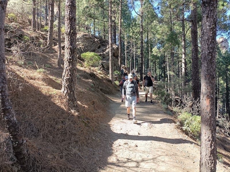
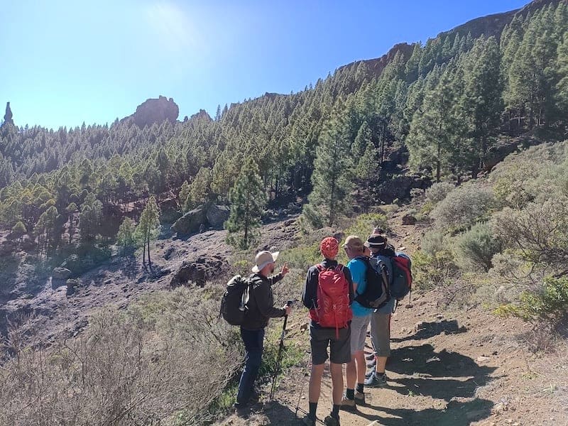
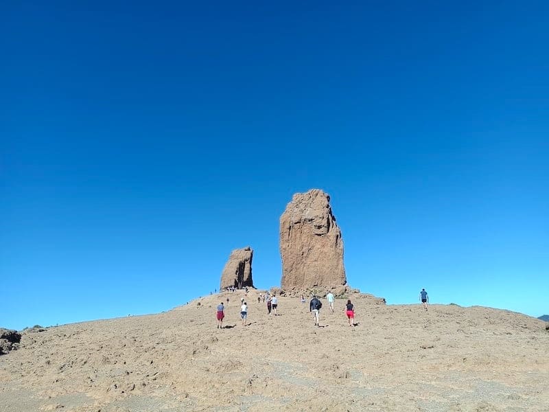
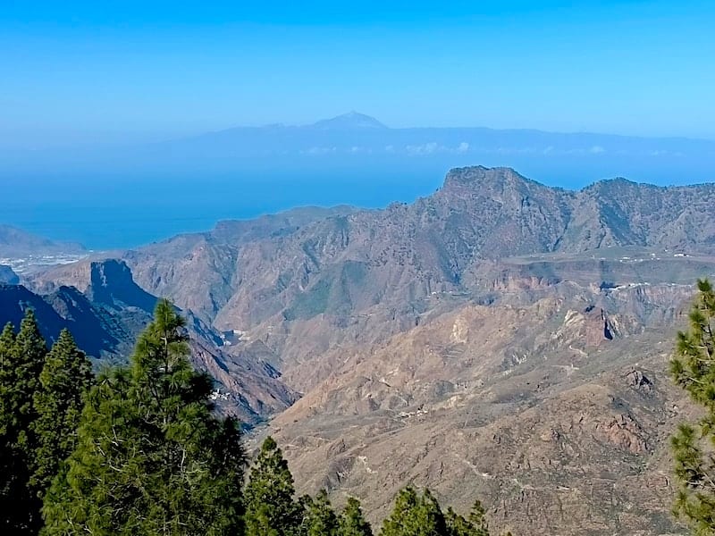
On this hiking excursion, discover Roque Nublo, a huge rock that’s 80 meters high and one of the most important natural symbols of Gran Canaria.
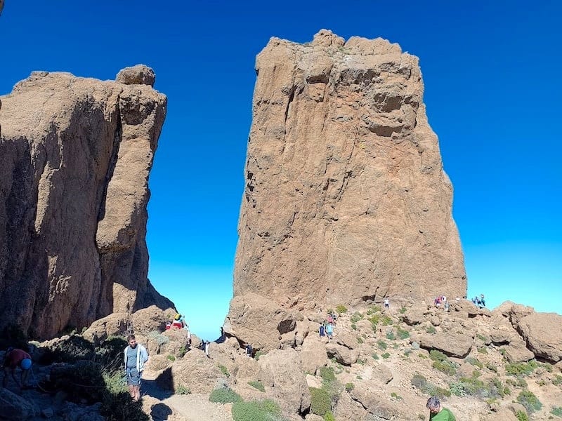
Even though the route aims to reach the base of Roque Nublo, located at an altitude of 1,750 meters above sea level, you’ll also be surprised by some of the landscapes found along the route.

As we’ll skirt the Roque Nublo, you’ll be able to take pictures from different angles and heights. However, the picture from the esplanade, near the great rock, will undoubtedly be your most remembered image.
On clear days we can see the peak of El Teide, Spain’s highest mountain, with 3718 meters above sea level, located on the island of Tenerife.
Throughout most of the route we’ll be surrounded by Canarian pines (pinus canariensis), typical trees for the island’s highlands, which can reach up to 25 meters. This and other information about the vegetation we’ll see will be provided by the guide.
Also during the route we’ll be able to admire, from a certain distance, the other great rock on the island, Roque Bentayga, 68 meters high. And since the base of Roque Nublo is the second highest point on the island, from here we can also see the nearby towns of Ayacata and Tejeda and even the Aldea de San Nicolás, located on the western end of the island.
And just as impressive as the views we’ll see while touring on foot, are the landscapes that we’ll find during the transfer to the starting point. We’ll go through arid areas that are characteristic of the south of the island, through palm groves areas a little further north and through the pine forest areas at the center of the island, from where we’ll start our hike.


In short, the Roque Nublo tour offers you the opportunity to reach the base of this great symbol of Gran Canaria while enjoying the magnificent views that you can get from visiting one of the highest spots on the island.
Recommendations:
Read the frequently asked questions and bring warm clothing as the temperature during the tour can drop below 10 degrees.
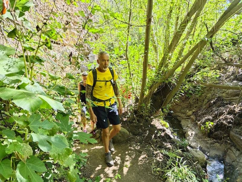
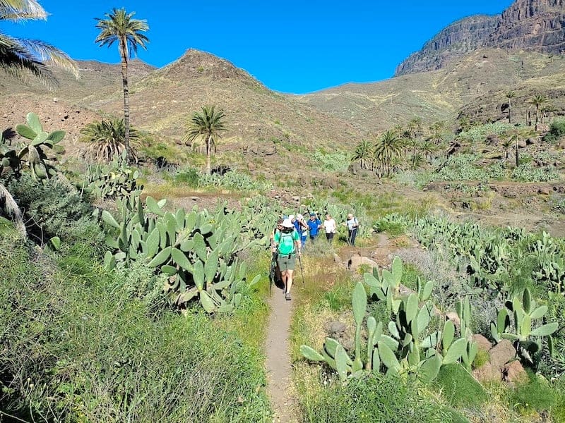
Hiking to the Krestel Canyon
![[cml_media_alt id='23003']Barranco de los Cernicalos ruta[/cml_media_alt]](https://www.okgrancanaria.com/wp-content/uploads/2023/01/Barranco-de-los-Cernicalos-1.jpg)
![[cml_media_alt id='23002']Barranco de los Cernícalos grafico[/cml_media_alt]](https://www.okgrancanaria.com/wp-content/uploads/2023/01/Barranco-de-los-Cernicalos-2.jpg)
Duration: 3-3,5 hours.
Days of the tour: Not available.
Schedule: 10:00am till 1:30pm.
Starting point: Merenderos Barranco de los Cernícalos.
Type of tour: Out-and-back.
Difficulty level: 1,5 (Moderate).
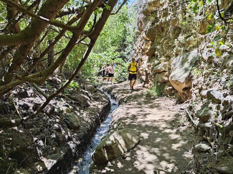
In our walk through the Cernícalos Cliff, we’ll get to see one of the most beautiful and spectacular trails on the island due to its abundant vegetation.
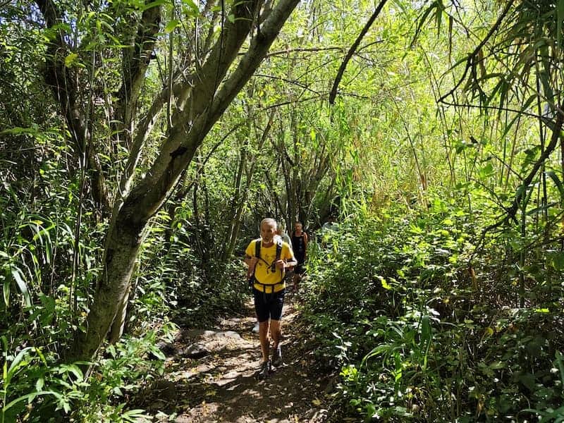
Unlike other more open hiking trails which show great landscapes, the walk through the Cerníclalos Cliff is done along a densely vegetated path where we can barely see beyond our surroundings.
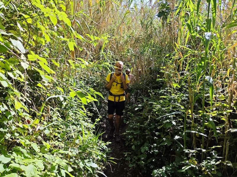
In fact, here we’ll discover an authentic Canarian willow and wild olive tree forest, which are two of the more than 60 species of plants that we’ll be able to see on the tour, of which more than 50% are endemic to the islands.
Don’t worry if you don’t know much about plants, the guide will constantly inform you about the flora and fauna that we find.
Among the birds that we’ll be able to hear and observe, we can mention the kestrels, small falcons that inhabit this area and which give the cliff its name.

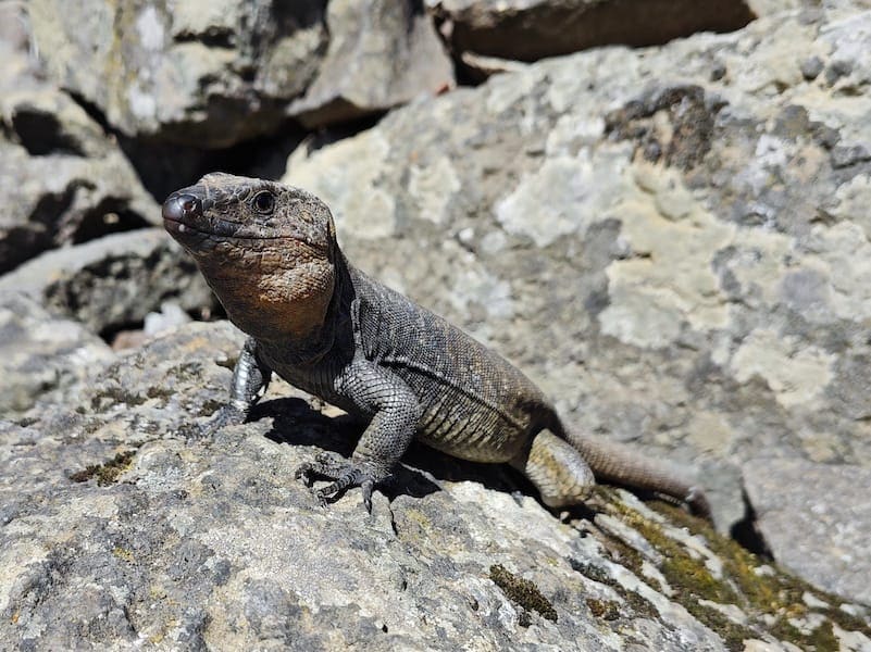
In addition to birds, in the stop that we’ll make to rest and regain our strength, we can also find some lizards that will timidly approach us in search of food.
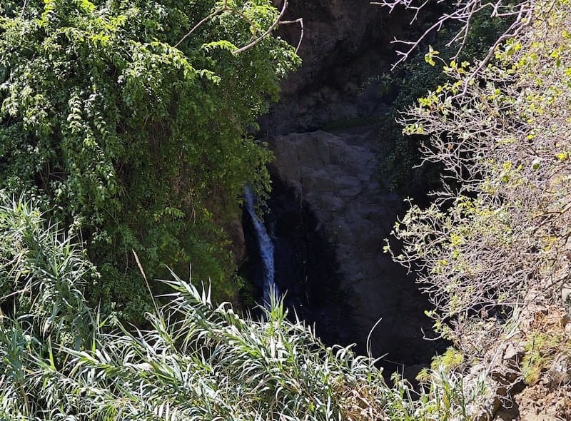
The entire hike is done parallel to a small stream bed that is fed by some waterfalls located at the end of the route. The relaxing sound of the water will make our route even more soothing and pleasant.
Although we will not reach the waterfalls, we’ll be able to spot one of them at a certain distance before returning, along the same path we came from, to our starting point.
In a few words, the hike through the Cernícalos Cliff is almost a must for hiking lovers due to its beauty, relaxation and diversity of flora and fauna.


Recommendations:
Read the frequently asked questions and bring warm clothing as the temperature during the tour can drop below 10 degrees.
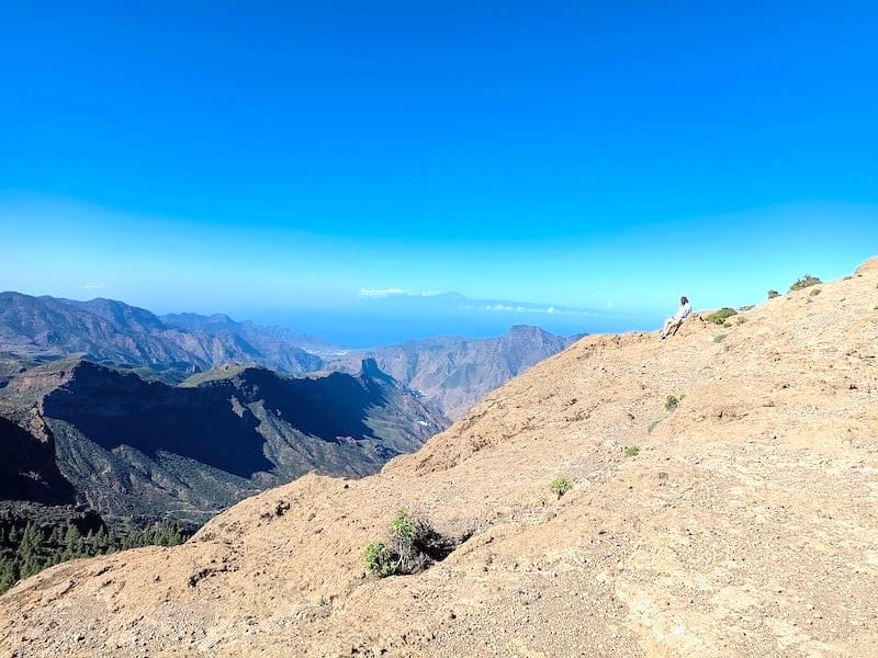
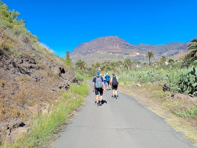
Rambling excursion in Barranco de Veneguera
![[cml_media_alt id='20659']recorrido Barranco de Veneguera[/cml_media_alt]](https://www.okgrancanaria.com/wp-content/uploads/2023/01/Ruta-Barranco-de-Veneguera.jpg)
Duration: 3 hours.
Days of the tour: Thursday.
Schedule: 10:00am till 1:00pm.
Starting point: Veneguera (town square).
Type of tour: Loop.
Difficulty level: 2 (Moderate).
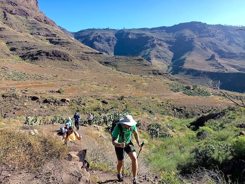
On this hiking excursion, explore the Barranco de Veneguera ravine, one of the most spectacular and beautiful in southern Gran Canaria. Even though the ravine is more than 10 km long and reaches Veneguera Beach on the southwest coast of the island, we’ll only do what’s known as the circular path of Veneguera through La Cogolla.
The weather in this part of the island is usually benign, which allows you to do the tour under clear skies and temperatures, where winter temperatures oscillate between 13 and 24 degrees.
The route begins and ends in the main square of the charming town of Veneguera, which has just 700 inhabitants.
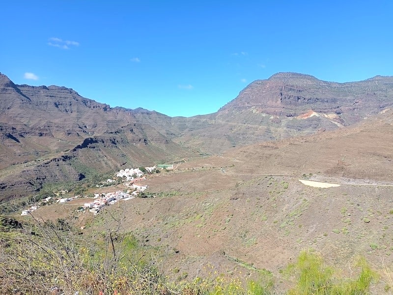
During the tour we’ll see avocado and mango plantations from nearby farms, as well as wild plants such as prickly pears and Canarian palm trees, typical of the southern part of the island.
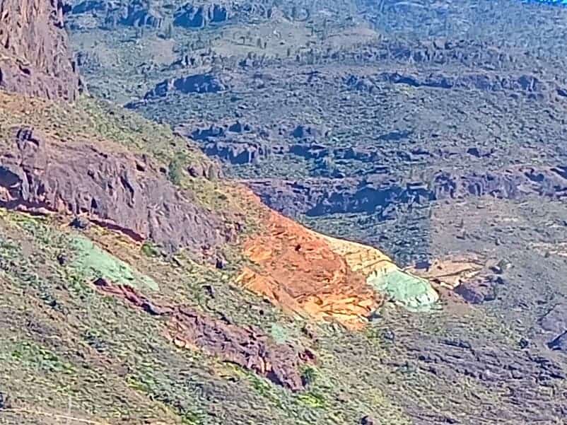
We’ll do the first part of the tour in the deepest area of the ravine, from where we’ll contemplate the huge steep walls that surround it.
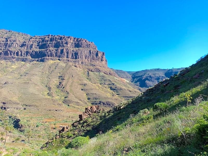
On one of these walls, we’ll see some colored stripes on the rock in a space known as Los Azulejos.
At the highest point of the route, in La Cogolla, we’ll reach 496 meters above sea level. At this point we’ll stop to eat, regain strength and take some splendid pictures of the ravine.
From La Cogolla the way back is quite steep and technical but following the guide’s instructions and advice will facilitate your trip through this complicated area.
![[cml_media_alt id='20689']senderimo Playa del Ingles[/cml_media_alt]](https://www.okgrancanaria.com/wp-content/uploads/2023/01/sendero-veneguera-8.jpg)
The last part of the route is much easier, flatter and goes along wide paths and roads, so you can take the opportunity to chat and discuss your experience with your fellow travelers while enjoying the beautiful views of the palm groves near the town of Veneguera.
In summary, the tour through the Barranco de Veneguera is a fun and technical excursion, with beautiful landscapes and which is usually done on sunny days with very pleasant temperatures.


Recommendations. Not recommended for people with vertigo.
Frequently Asked Questions – Hiking Excursions
-
Which hiking route should I choose?
Choose the route that best suits your interests based on landscape, vegetation, difficulty level, duration, departure day and weather conditions.
Routes in the south of the island, such as Barranco de Veneguera, usually offer good weather all year round. In central and northern areas, partly cloudy days are more common.
-
Can routes vary depending on the season?
Yes. During summer, routes in the southern part of the island are avoided due to high temperatures.
-
What does the accident insurance cover?
The insurance covers rescue operations and any kind of incident during the excursion.
-
How many people are there per guide?
The maximum number of participants per guide is 12.
-
What kind of vehicles are used for transportation?
Transfers are made using vans with a maximum capacity of 9 seats, including the driver.
-
In which languages are the excursions conducted?
Hiking excursions are usually conducted in English and German.
-
In which cases can an excursion be cancelled?
Excursions may be cancelled due to adverse weather conditions such as heavy rain, storms or extreme heat.
-
What clothing should I wear?
Clothing depends on the season. During winter months, warm clothing is recommended as temperatures in the mountains can drop below 10 °C.
You should also bring a hat, sunglasses and a backpack for water and the picnic provided before the hike.
-
What footwear is required?
Hiking shoes are mandatory. If you don’t have them, you can rent a pair when booking and indicate your shoe size.
-
What physical requirements are needed?
A good physical condition is required.
-
Are there any restrictions?
Hiking is not suitable for people with reduced mobility or pregnant women. The minimum age is 12 years.
-
What is the difficulty level of the tours?
Most of the hiking tours have a medium difficulty level.
-
What happens if it rains on the excursion day?
If heavy rain is expected, the route is changed to another area with better weather conditions.
-
How far in advance should I book?
As groups are small, availability is limited. We recommend booking as early as possible.


Latest Reviews
Share your experience